The Norse Discovery of America, by A.M Reeves, N.L. Beamish and R.B. Anderson, [1906], at sacred-texts.com
The Norse Discovery of America, by A.M Reeves, N.L. Beamish and R.B. Anderson, [1906], at sacred-texts.com
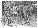
THE early discovery of this country by the Norsemen is of interest to every American. It is the first coming of Europeans to this continent. It is the first chapter of civilization in the Western world. It is also the first chapter of the history of the Christian Church in America; for Leif Erikson and his followers had been converted to Christianity and Leif was himself a missionary sent out by the king of Norway to preach the gospel of the Gallilean to the Norse colonists in Greenland.
Before the landing of the Pilgrims at Plymouth Rock in 1620, the shores of North America had been visited by the so-called French voyageurs. Some of these explorers wrote accounts of their voyages, and in their narratives and on maps which they published there is frequent mention of the name Norumbega. The name is found with a variety of spellings, Norumbegue, Norumbergue, sometimes with the initial "n" omitted, Anorabegra, Anorumbega, etc. It is applied to a country, river and city located somewhere in the eastern part of the United States or Canada. It is said to have been discovered by Verrazzano, in 1524. The site of the city
was given on a map published at Antwerp in 1570. In 1604 Champlain ascended the Penobscot River in Maine, supposing that stream to be the Norumbega. But after going twenty-two leagues he discovered no indications of a city or of civilization except an old moss-grown cross in the woods. American historians have found much difficulty in identifying Norumbega, The fact is the statements of the various French authorities are conflicting. As stated, the first mention is by Verrazzano on his map published in Antwerp in 1524, and later, that is, in 1539, Parmentier found the name Norumbega, applied to a country lying southwest from, Cape Breton. Allefonsce, under Roberval, in 1543, determined the fact of there being two Cape Bretons, of which the more southern, referred to by Parmentier, was in the forty-third degree and identical with Cape Anne. Within the limit of this forty-third degree was a river, at the mouth of which, according to Allefonsce, were many rocks and islands; up which river, as Allefonsce estimated, fifteen leagues from the mouth was a city called Norumbegue. "There was," Allefonsce said, "a fine people at the city and they had furs of many animals and wore mantles of martin skins." Allefonsce was a pilot by profession and on him particularly rests the identity of one of the Cape Bretons which Cape Anne and the fact of there being a river with a city on its banks, both bearing the name Norumbega between Cape Anne and Cape Cod. Wytfliet, in 1597, in an augment to Ptolemy, says, "Norombega, a beautiful city and a grand river, are well-known." He gives on his map a picture of the settlement, or villa,
at the junction of two streams, one of which is called the Rio Grande. Thevet in his texts places Fort Norumbegue at the point where Wytfliet placed the city, that is, at the junction of two streams, and Thevet says "To the north of Virginia is Norumbega, which is well-known as a beautiful city and a great river. Still one can not find whence this name is derived, for the natives call it Agguncia. At the entrance of the river there is an island very convenient for the fishery." Thevet describes the fort as surrounded by fresh water and at the junction of two streams. The city of Norumbega on his map is lower down the river. The French, who occupied the fort, called the fort Norumbega. As stated, the identification of Norumbega has greatly puzzled American historians, and the country, river and city have from, time to time been located at various points from Virginia to the St. Lawrence. Most authorities have referred Norumbega to New England, while Lok, in 1582, seems to have believed that the Penobscot in Maine formed its southern boundary. Before 1880 this view seems to have been very generally adopted by American scholars. Our poet, J. G. Whittier, made Norumbega the subject of one of his most beautiful poems.
In connection with the poem, the poet gives the following explanatory note, which well represents the concensus of opinion of American scholars before 1880: "Norembega, or Norimbegue, is the name given by early French fishermen and explorers to a fabulous country south of Cape Breton, first discovered by Verazzano in 1524. It was supposed to have a magnificent city of the
same name on a great river, probably the Penobscot. The site of this barbaric city is laid down cm a map published at Antwerp in 1570. In 1604, Champlain sailed in search of the Northern Eldorado, twenty-two leagues up the Penobscot from the Isle Haute. He supposed the river to be that of Norembega, but wisely came to the conclusion that those travelers who told of the great city had never seen it. He saw no evidence of anything like civilization, but mentions the finding- of a cross, very old and mossy, in the woods."
In 1881 Arthur James Weise, of Troy, N. Y., published a work called "The Discovery of America to the Year 1525." In the closing pages of this work he takes up the subject of Norumbega, and arrives at the conclusion that the name is a contraction of the old French L'Anormeeberge (the grand scarp), and claims that the adjective "anormee" and the noun "berge" definitely describe the wall of rocks known as the Palisades, on the Hudson river, above New York city. Weise has no doubt that by the term Norumbega river the Hudson is meant, and that the country around the Palisades was called by the French explorers La Terre d'Anormeeberge, afterwards contracted and corrupted into Norumbega and its other variations heretofore named. In identifying the river called by one of the French writers Norombega, with the present Hudson, Weise lays great stress upon the statement by the same writer that the water of the river was salty to the height of forty leagues, and shows that the Hudson is brackish beyond the city of Poughkeepsie. According to Weise, the city of Norumbega

Click to enlarge
MAP OF VINLAND from accounts contained in Old Northern MSS
must have occupied the site of the present Albany, the capital of New York. Weise's arguments seemed so conclusive, particularly his interpretation of the name, that his view was very generally accepted by students of American history everywhere.
Passing on to the year 1890, we come to an entirely new theory. Before presenting this in detail it may interest my readers to learn a few facts leading up. to it. In 1873 I suggested to the famous Norwegian violinist, Ole Bull, that Leif Erikson, the first white man who planted his feet on American soil, ought to be honored with a monument. Ole Bull accepted the suggestion with the greatest enthusiasm, and he and I together immediately prepared plans for its realization. During the spring of 1873 we arranged a number of entertainments in Wisconsin and Iowa, the proceeds of which made the nucleus of the Leif Erikson monument fund. At these entertainments Ole Bull played the violin and the writer sandwiched in short addresses to the audiences while the artist rested. Later, that same year, I accompanied Ole Bull to Norway, and there a series of entertainments were arranged for the same purpose. At one of these entertainments the distinguished Norwegian poet, Bjornstjerne Bjornson, delivered an address. A sum of money was realized from the entertainments in Norway for the monument fund. A few years later Ole Bull made his American home in Cambridge, Mass.; there he was successful in organizing a committee for the purpose of carrying out our plans in regard to the Leif Erikson monument. The committee was a most brilliant one.
[paragraph continues] In it were found James Russell Lowell, Henry Wadsworth Longfellow, Oliver Wendell Holmes, Thomas S. Appleton, Prof. E. N. Horsford, the Governor of Massachusetts, the Mayor of Boston and many other distinguished people. Funds were rapidly raised, and America's most distinguished sculptress, Miss Anne Whitney, 1 was engaged to produce in bronze a statue of Leif Erikson in heroic size. In due time the statue was completed and placed at the end of Commonwealth Avenue in Boston. The statue represents Leif Erickson as he discovers the first faint outlines of land far away on the horizon, and with his right hand he shades his eyes from the dazzling rays of the sun. The statue does not represent my idea of a long bearded and shaggy haired Norseman of the tenth century. Miss Whitney has made Leif smooth faced, with the general outlines of the Roman. She seems to have taken the splendid physique and features of Ole Bull for her model. But it is certainly a great work of art. No less authority than James Russell Lowell declared it to be the finest work of sculpture hitherto produced in America. A perfect replica, cast in the same mold as the original, was presented by a Milwaukee lady to the city of Milwaukee, where it can be seen by my readers. It stands on the lake front, a little north of the Chicago & Northwestern railway station, near the well-known Juneau monument.
It will be observed that Prof. Horsford was mentioned as one of the committee in Cambridge. Prof. Eben Norton
[paragraph continues] Horsford, born July 27th, 1818, was the son of a distinguished missionary among the Indians. The son, Eben., acquired from his father, who was thoroughly familiar with many Indian dialects, an extensive knowledge of Indian words. He studied science both in America and in Europe under Prof. Liebig, and became Professor of Science in Harvard University in 1847, a position which he filled with distinction for sixteen years. Fortune smiled on him. He became wealthy and was able to devote his time exclusively to scientific and literary pursuits. He was a large hearted man and gave generously of his wealth to educational institutions. Wellesley College is under great obligations to him.
The organization of the Leif Erickson committee in Cambridge attracted his attention to the subject of the Norse discovery of America. The result was that he practically abandoned his other studies and concentrated all his energies on investigations bearing on the Norse voyages to this country. He was particularly interested in locating the landfall of Leif Erikson and in identifying the country explored by him and his countrymen from the tenth to the fourteenth century. Some idea can be formed of Prof. Horsford's enthusiasm in this cause when we learn that he spent more than $50,000 in making explorations, in publishing books and maps, and in building monuments and memorials in honor of the Norse discoverer. He was the orator at the unveiling of the Leif Erikson monument in Boston.
In 1890, Prof. Horsford presented an entirely new theory in regard to the perplexing question of Norumbega.
[paragraph continues] In this year appeared his "Discovery of the Ancient City of Norumbega." In it he claims to have found the precise site of the ancient city, and locates it with absolute confidence on the Charles river, in Massachusetts, at its junction with Stony Brook, near Walton. He makes Norumbega identical with the Vinland of the Norseman, claiming that Norumbega is not derived from the old French D'Anormee Berge, but is a corruption of the old name Norvegr and that it has borne that name among the aborigines ever since the Norse explorers in the tenth and following centuries made their headquarters there. He takes Norumbega to be the name the French voyageurs did not bestow but found. So thoroughly convinced was Prof. Horsford of the correctness of his theory that he built on the site which he identified as Norumbega a costly tower in commemoration of the Norse discoverers and colonists. Prof. Horsford found at and around the junction of Stony Brook with Charles river evidences of a great industry involving, among other things, a graded area some four acres in extent, paved with field boulders. At the base of the bluffs along Stony Brook there are ditches or canals extending far into the country and above the ditches are walls made of boulders from three to five feet high. The existence of these works has long been known, but their origin has never been satisfactorily interpreted. It is certain that they existed before the landing of the Pilgrim Fathers in 1620. It is equally certain that they are the handiwork of man. They are too extensive to have been produced by the French or English explorers previous
to 1620. They can scarcely be ascribed to the aborigines, for they differ widely from any works known to have been constructed by the natives of this country. The old Norse sagas tell us that the Norseman carried timber from Vinland to Greenland and Prof. Horsford suggests that the canals were filled with water at high tide and that logs were floated down to where their ships lay in the Charles river. He supposes that the walls above the canals were constructed to protect the canals from being filled with debris from the bluffs. When the immediate shores of the river had been cleared of wood the shores of the tributaries flowing into the river became the field of activity and maple blocks were sent floating down the stream; and where the streams were remote from the bases of the slopes on either side the sources of water were at hand. Canals, or nearly level troughs, were dug to transport the logs to the streams and ultimately to the Charles. Dams and ponds were necessary at the mouths of the streams to prevent the blocks from going down the Charles without a convoy and out to sea to be lost. There is an admirable canal, walled on one side, extending for a thousand feet along the western bank of Stony Brook in the woods above the Tiverton railroad crossing, between Walton and Weston. The Cheesecake Brook is another and Cold Spring Brook another, and there is an interesting dry canal near Murray Street, not far from Newtonville. It may be seen from the railroad cars on the right, a little to the east of Eddy Street, approaching Boston. Prof. Horsford found throughout the basin of the Charles numerous
canals, ditches, deltas, boom-dams, ponds, fish-ways, forts, dwellings, walls, terraces of theatre and amphitheatre, and he insisted that there was not a square mile drained into the Charles River that lacked an incontestable monument of the presence of the Norsemen. I have myself gone over the most of this ground in company with Prof. Horsford and listened to his enthusiastic interpretations of these strange remains. It may seem as an undeserved dignity to speak of these ditches as canals, but they are so named in the old deeds in Weston, and if you look at them on the left of the highway, between Sibley's and Weston, with the stone wall on either side, you will not wonder that the word canal, as well as ditch, should have suggested itself. They are so called on the published town maps of Millis and Holliston. Prof. Horsford, as indicated, bought a tract of land at the junction of Stony Brook with Charles River, consecrating it to the memory of the Norsemen, and set up in Weston, at the mouth of Stony Brook, a magnificent tower. Over the tablet, set in the wall of the tower, is poised the Icelandic falcon about to alight with a new world in his talons. On the tablet is given the following inscription:
A. D. 1000, A. D. 1889.
NORUMBEGA.
City--Country--Fort--River.
Norumbega--Nor'mbega.
Indian utterance of Norbega, the Ancient Form of Norvega,
Norway, to which the Region of
Vinland was Subject.
City.
At and near Watertown,
Where Remain To-day
Docks, Wharfs, Walls, Dams, Basin.
Country:
Extending from Rhode Island to the St. Lawrence.
First Seen by Bjarni Herjulfson, 985 A. D.
Landfall of Leif Erikson on Cape Codd, 1000 A. D.
Norse Canals, Dams, Walls, Pavements.
Forts, Terraced Places of Assembly, Remain To-day.
Fort:
At Base of Tower and Region About
Was Occupied by the Breton French in the 15th, 16th and
17th Centuries.
River:
The Charles,
Discovered by Leif Erikson 1000 A. D.
Explored by Thorwald, Leif's Brother, 1003 A. D.
Colonized by Thorfinn Karlsefni 1007 A. D.
First Bishop Erik Gnupson 1121 A. D.
Industries for 350 Years.
Masur-wood (Burrs), Fish, Furs, Agriculture.
Latest Norse Ship Returned to Iceland in 1347.
Prof. Horsford mentioned as considerations that led to the erection of the tower:
"1. It will commemorate the discovery of Vinland and Norumbega in the forty-third degree, and the identification of Norumbega with Norway, the home country to which this region was once subject by right of discovery and colonization.
"2. It will invite criticism, and so sift out any errors of interpretation into which, sharing the usual fortune of the pioneer, I may have been led.
"3. It will encourage archæological investigation in a fascinating and almost untrodden field, and be certain to contribute in the results of research and exploration, both in the study and the field, to the historical treasure of the commonwealth.
"4. It will help by reason of its mere presence, and by virtue of the veneration with which the tower will in time come to be regarded, to, bring acquiescence in the fruit of investigation, and so allay the blind skepticism, amounting practically to inverted ambition, that would deprive Massachusetts of the glory of holding the Landfall of Leif Erikson, and at the same time the seat of the earliest colony of Europeans in America."
In the old Norse sagas (histories) in which the Norse voyages to America are described, it is stated that when Leif Erikson came to Vinland he first sailed up a river, that the river then widened into a lake, that he crossed this lake and then sailed up another river as far as his ship could float. Such a description might doubtless apply to various points on the northeast coast, but it certainly applies well to the Charles river.
In 1887, at a scientific gathering in Cambridge, Prof. Horsford announced that he had studied the saga of Erik the Red and that he interpreted the brief but clear statement therein to refer to Leif's sailing across the mouth of Cape Cod Bay opening out northeast to the sea from the Race to the Gurnet; his coasting westerly along
the Gurnet from Scituate Beach past the Cohasset Rocks to Nantasket, his entrance into Boston harbor, his running aground on an ebb-tide off the site of Long Wharf, his floating on the returning flood up into the reach or strait of Charles river, on to the expansion of the back bay, and later winding through the salt meadow and marshes up the Charles, beyond the bay to the south end of Symond's Hill at the so called Gerry's Landing in Cambridge, near which he built his large house, as indicated in the details given concerning Leif, Thorwald and Thorfin Karlsefne in the sagas. At the same time Prof. Horsford stated that if any remains of Leif's house in Vinland should ever be found they would be located between Symond's Hill, the ancient bluff extending eastward some hundred yards from the Cambridge City Hospital, and the angle of the Cambridge City Cemetery, about a quarter of a mile to the south. The place where Leif landed would be, Horsford insisted, the first place going up the Charles, where, landing on an even keel, permitting a plank to be run out to the shore was possible. It was the spot determined for Gerry's Landing, the great point in the earlier days of the colony for receiving goods from the sea and transporting them on wagons to the interior. Mr. Horsford made careful investigations in this vicinity and discovered in the turf a ridge, the outlines of which correspond with the outlines of an Icelandic house in the saga time. The old Norse house had a fire place in the centre of the floor and the smoke escaped through an opening in the roof. Prof. Horsford was so sure that this characteristic of the
house near Gerry's Landing would be found that he announced it to the workmen, who of course showed the greatest incredulity. He told them that if they would dig a trench along the middle of the house they would uncover a fire place. The turf and blown sand were a foot thick. He indicated the spot where the hearth would be found. His prediction was verified. An area of about four feet in diameter, covered by boulders, was exposed. Some were more fine grained and compact, preserving their original shape, but pitted at the surface as if they had been exposed to prolonged heat. Others were cracked into several pieces. Others still, being originally fissile gneiss finely stratified sand and argillaceous material, were resolved into different fragments like slate. Ore of the blocks that had preserved its general form, but with all its corners rounded, was observed to be of a dull red as if covered with reddish brown rouge. Horsford said: "If this redness is due to peroxide of iron I shall find the interior of a greenish shade due to the presence of mineral combinations with protoxide of iron." A lapidary cut the stone into thin slices. Horsford says: "As I expected, in the interior where, though heated, it had been protected from the air, the color was of a dull bottle green. The outer surface where it had been heated and exposed to the air was reddish brown. Charcoal was found, as might have been expected, at the border of the hearth."
Mr. Horsford found on the south side of the outline a marked depression, as if there had been a door. If there were door posts they should have had something to stand
on. On digging down a foot or more on either side of the door-way a boulder of two-thirds of a bushel basket capacity was found. The outline of the house of logs might have been expected to rest on stone as a protection against the decay of the logs. Such stone foundations were found in probing the ground with an iron rod at a depth of about one foot and were at various points uncovered. The whole outline of the house is a regular parallelogram. Prof. Horsford had this interesting place enclosed and suitably marked.
On the last night of the year 1892, Eben Norton Horsford called his daughter Cornelia to talk with her about the traces of the house built on the banks of the Charles River, both by Thorfin Karlsefni and Snorre Thorbrandson, two Icelanders who came from Greenland in three ships with 151 men and seven women and their live stock, intending to establish a colony in Vinland, in the year 1007. Prof. Horsford asked his daughter, "What will you find in Thorfin's house if I find a fire place in Leif's house? And if I found foundations of walls at Leif's house, what will you find to correspond with that at Thorfin's house?" Then he instructed her to buy the land herself, and in the spring, when the frost was out of the ground, to get an iron rod and strike it into the earth to find the fire place, and afterwards to find the foundation walls in the same way; because he wanted her to have the pleasure of making a discovery herself. The next day, January 1st, 1893, our dear old Prof. Horsford died suddenly in his library. Miss Cornelia Horsford afterwards got her mother's permission to finish
and edit her father's unpublished works, and during the long days and evenings, while the ground was still covered with snow, she read all the books about the ancient Norsemen and their customs to learn what she might happen to find when the time came in the spring for her to look for the remains of Thorfin's long house on the bank of the river. On the 19th of April, when the frost was out of the ground, she began her search for the remains of the long house of Thorfin's party. It is no easy matter to find the foundations of a house after they have been buried several hundred years, even when they can be traced by ridges of earth. For an hour, she says, she watched the earth thrown up, and probed the ground in vain. At noon she went for Mr. Scorgie, who had made the search at Leif's house under her father's direction, and asked him to show her how to find the foundations and fire place of this house. He soon found them for her. The ring of the iron rod against the stone as he struck on the north wall was distinct and sharp, and in the afternoon he had outlined with the rod two walls about sixty-four feet long, having first found the end wall at the south. She was troubled by the fact that she found two fire places, but in examining the Yuglinga saga of Snore Sturlason, Chap. 14, she found that large buildings sometimes had more than one fire place. The stones which showed the action of heat were neatly laid together, with a few clam shells and oyster shells near by. She did not carry the excavations any further because her father did not wish to have the ridges destroyed by which he discovered the site of the house.
[paragraph continues] Near by, and yet undisturbed, there are traces of other houses.
In 1892 I visited Prof. Horsford and he took me first to the junction of Stony Brook with Charles River, and showed me the magnificent monument he there had erected. He pointed out to me the four acres of solid pavement and showed me the long stretches of canals and stone walls. Afterwards he took me down to Gerry's Landing and he made me discover the site of Leif Erikson's house myself. I left him and went to where I could see a ridge in the form of a parallelogram in the sod, and walked slowly over its four sides, Prof. Horsford in the meantime clapping his hands. The stone from the fire place he subsequently had cut into thin slices, and one of these he sent me as a present on Christmas, 1892, only a week before his death. Prof. Horsford had not the slightest doubt that he had identified and explained satisfactorily the Norumbega of the French voyageurs. He had the fullest faith that Norumbega was a corruption of the ancient name Norvegr, that this name had been given to the aborigines by the Norsemen and that the aborigines had handed it down from generation to generation and had spoken it to the French voyageurs. He made the most careful investigations and found that no house had been built near Gerry's Landing since 1620. He therefore became absolutely convinced that the outlines which he described must be referred back to the house built in this country in the tenth and eleventh centuries by Leif Erikson and the other Norse explorers. Prof. Horsford was very anxious
to convince me that he was right and my readers are doubtless anxious to know my opinion about the matter. I am sorry that I am not able to express a conviction on the subject. Horsford's discoveries are most startling, but they seem to prove too much. I am hospitably disposed to the basin of the Charles River as the site of Vinland and the operations of the Norse discoverers. All the descriptions in the sagas apply remarkably well to the Charles River with its surrounding country, and it is more than probable that Leif Erikson trod the ground now occupied by Harvard university. The remains pointed out by Horsford, both those near Weston and those near Gerry's Landing, deserve to be carefully studied, and it is possible that a thorough investigation will confirm many of Horsford's conclusions.
300:1 Miss Anne Whitney was born in Watertown, Mass. She opened a studio as sculptress in Boston in 1873, and has made among other notable works, a statue of Samuel Adams and one of Harriet Martineau.